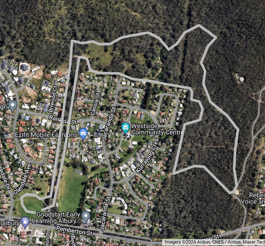
Start Line is at Bonnie Doon Park.

After running the length of the reserve the next 450 metres to the Nail Can Hill reserve rises slightly, crosses Banksia Street, and meanders through the trees. Then there is a right angle turn to the east/right. The track follows an undulating trail along the northern side of the dwellings for about 490 metres then there is a right angle turn to the south/right.
The track then slopes down to a creek about 260 metres to the south. Once across the creek the track continues in a southerly direction for another 170 metres where the track then has a sharp turn to the east/right and rise moderately for about 330 metres towards the water tank. This is the steepest part of the short course. Runners then go around the eastern side of the tank and join the main race track at this water station.
All runners should keep to the left once they get onto the main track so faster runners can pass on the right.
This will be the only water station for the 4 Km Course. Make sure you take a drink here and thank the volunteers from the West Albury Public School.
From this drink station there is about 2.3 kilometres to the finish line. For the next kilometre the track is generally slightly undulating as it contours around the base of Nail Can Hill and crosses a creek. The track then rises sharply for a short section. From here the course is pretty much all down hill to the finish with the odd undulation and creek crossing.
The track then heads south down through the bush corridor between the two West Albury housing estates, across Banksia St and continues towards the park, at the end of the houses there is a sharp right hand turn into the Bonnie Doon Park. Follow the marked track onto the oval and across to the finish line. There is always a great atmosphere amongst the crowd at the finish, enjoy swapping your experiences on the track with your fellow competitors.
After the Race
Medals will be awarded to under 12’s and there are a small number of prizes for the other categories.

